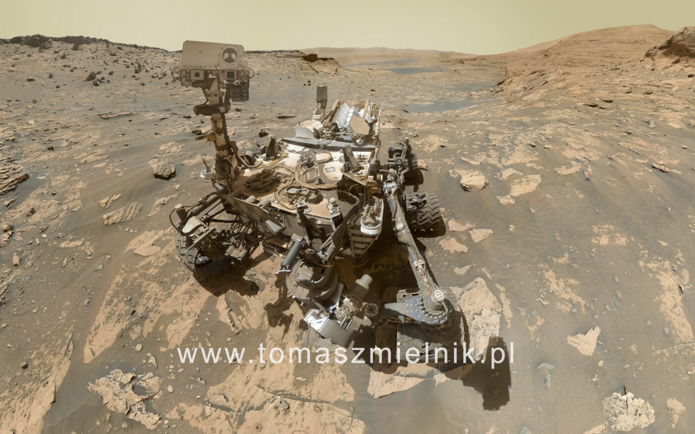
Mars Panorama – Curiosity Rover: Martian Solar Day 3303.
Http iframes are not shown in https pages in many major browsers. Please read this post for details.Image and text credit: NASA/JPL-Caltech/MSSS
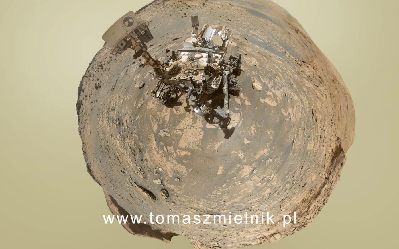
Panorama360 credit: Tomasz Mielnik
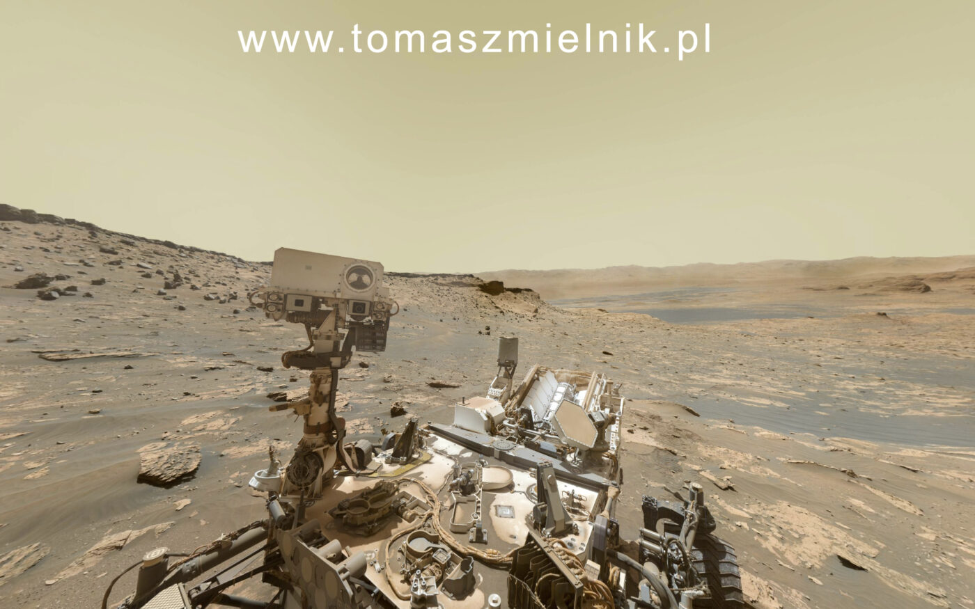
This panorama features 81 exposures taken by the Mars Hand Lens Imager (MAHLI) rover during Sol 3303 from Curiosity on Mars (November 20, 2021)
At the center of the image is the view back down Mount Sharp, the 3-mile-tall (5-kilometer-tall) mountain that Curiosity has been driving up since 2014. Rounded hills can be seen in the distance at center-right; Curiosity got a closer view of these back in July, when the rover started to see intriguing changes in the landscape. A field of sand ripples known as the “Sands of Forvie” stretches a quarter- to a half-mile (400 to 800 meters) away.
At the far right of the panorama is the craggy “Rafael Navarro Mountain,” named after a Curiosity team scientist who passed away earlier this year. Poking up behind it is the upper part of Mount Sharp, far above the area Curiosity is exploring. Mount Sharp lies inside Gale Crater, a 96-mile-wide (154-kilometer-wide) basin formed by an ancient impact; Gale Crater’s distant rim stands 7,500 feet tall (2.3 kilometers), and is visible on the horizon about 18 to 25 miles away (30 to 40 kilometers).
NASA’s Mars rover Curiosity acquired this image using its Mars Hand Lens Imager (MAHLI), located on the turret at the end of the rover’s robotic arm, on November 20, 2021, Sol 3303 of the Mars Science Laboratory Mission, at 21:19:15 UTC. Credits: NASA/JPL-Caltech/MSSS.
Panorama 360 Credit: Tomasz Mielnik – www.tomaszmielnik.pl
View panorama in serwis Kuula.co and 360cities.net
Credit
Image and text credit:
NASA/JPL-Caltech/MSSS
Tomasz Mielnik – www.tomaszmielnik.pl – post-production, patching, color grading, image, little planet,